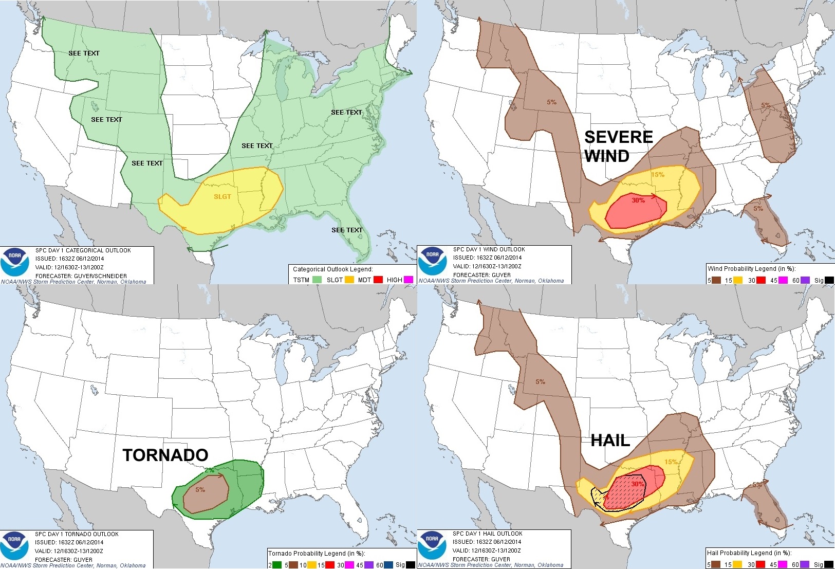
The main threats today will be for large hail (up to baseball size!) and damaging winds. However, an isolated tornado threat cannot be ruled out.
What's causing all of this today? First, let's take a look at the atmosphere.
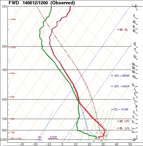
This chart, referred to as a SKEW-T diagram, is generated from an instrument called a Radiosonde. This instrument is attached to a balloon. Twice a day, local weather service offices release these balloons so meteorologists can get an idea of the atmosphere. The red solid line is a plot of temperature from the surface (at the bottom of the chart) all the way up into the atmosphere. The top of this chart is over 15 km high! The solid green line is the plot of the dewpoint, or the amount of moisture in the atmosphere.
If you follow the temperature plot from the surface, you see that it goes to the right. Then, higher up, it turns back to the left. When the temperature plot moves right as you go up, this is called a temperature inversion. In other words, the air is getting WARMER as you go higher, no colder as you would expect. This temperature inversion, called the CAP, limits storm potential.
But just above the CAP, the temperature curve heads left FAST. In other words, the temperature gets very cold, very fast. This creates a condition called INSTABILITY. Think of it this way: if a ball (or parcel) of warm air at the surface can get lifted up past the cap, the warm air will begin to rise on its own - because it's warmer than the air surrounding it. The warmer the air, the faster it will rise, the faster it rises, the higher in the atmosphere it gets. This, among other factors, is what leads to a large hail risk.
An important thing to note is that because of a CAP, air doesn't just rise up on it's own and become buoyant (well, it can sometimes - but that's for another topic). In order for it to get above the CAP, it has to have help. Typically some sort of lifting mechanism is needing to help the air rise. In today's forecast, we're expected to have a cold front surge south. When this colder air (which is heavier than warm air) comes into the area, it helps to lift the warmer, moister air that's already present up past the CAP. This is why storms typically form in front and along cold fronts.
Another similar lifting mechanism is an outflow boundary. This is a wave of cool air that gets pushed out and away from other thunderstorms. The storms earlier this morning (some of which became severe) formed along an outflow boundary which was created from decaying thunderstorms in Oklahoma overnight.
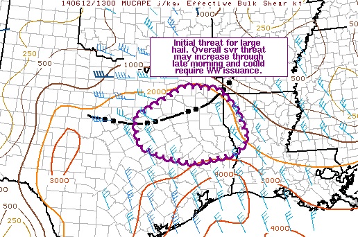
The image above shows the approximate location of the outflow boundary this morning. It's represented by the black dotted/solid line. This provided the lift needed for this morning's storms.
Our local National Weather Service office recently issued this graphic.

While the DFW Metroplex is still in a severe risk area, the greatest risk for today will be around and south of the previously discussed outflow boundary.
Stay safe today and keep an eye to the skies!
-Andrew