There was a fairly complex scenario unfolding throughout the day. First, a large group of thunderstorms, known as an MCS, was surging eastward along the Red River - the border between Texas and Oklahoma. This storm complex was creating an outflow boundary which was expected to interact with a cold front and dry line that was forecast to pass through the area later in the day. Mix in strong wind shear - a change in wind direction with height - and very high humidity and you have all the ingredients for some crazy weather. By 9:50 AM, the SPC had already issued Mesoscale Discussion #583 giving an 80% chance of a tornado watch being issued.

25 minutes later - at 10:15AM, Tornado Watch #155 was issued for a large part of Texas. A previously issued watch encompassed eastern Oklahoma and western Arkansas.

By 11:30 AM (1630Z) the SPC upgraded an area of Central Texas to the moderate risk for severe weather.

We had made plans to all go out to Panera for a Mother's Day lunch and I had pretty much assumed that storm chasing would be a taboo subject and completely out of the question - no matter how good the setup was. To taunt me even further the 3PM (2000Z) SPC update further expanded he moderate risk area to encompass a large area of North Texas - and our area was completely in the target area.

Other than going out for lunch, we stayed home and laid low. By afternoon the kids were getting restless and I'm sure that my frequent glances at the radar and mentions of weather watches had absolutely NOTHING to do with what happened next, but it was my WIFE who suggested that we go storm chasing. Despite assurances that this was her day and that it was almost getting too late in the day to chase, she insisted. Now who am I to argue with such a request? We packed the kids in the car (they like to go too!) and went to go pick up my dad - who is typically the designated navigator when we chase.
Shortly after 4PM, we headed out. Our targets were extremely limited and when I say limited, I mean there was only one - an exceedingly large severe thunderstorm west of Waco, TX. My plan was to head south down I-35 and cut west on US-84 and head toward the storm. The problem with this plan was that it was getting pretty late in the day and the target was pretty far. Despite my best efforts to stay positive, I had pretty much come to the conclusion that we'd drive until dark and if we were lucky, we'd maybe see a cool shelf cloud or something. At 4:23 PM, the target storm became tornado warned. This certainly piqued my interest, but I was keeping hopes at bay.
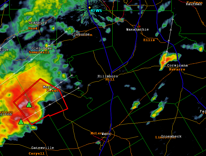
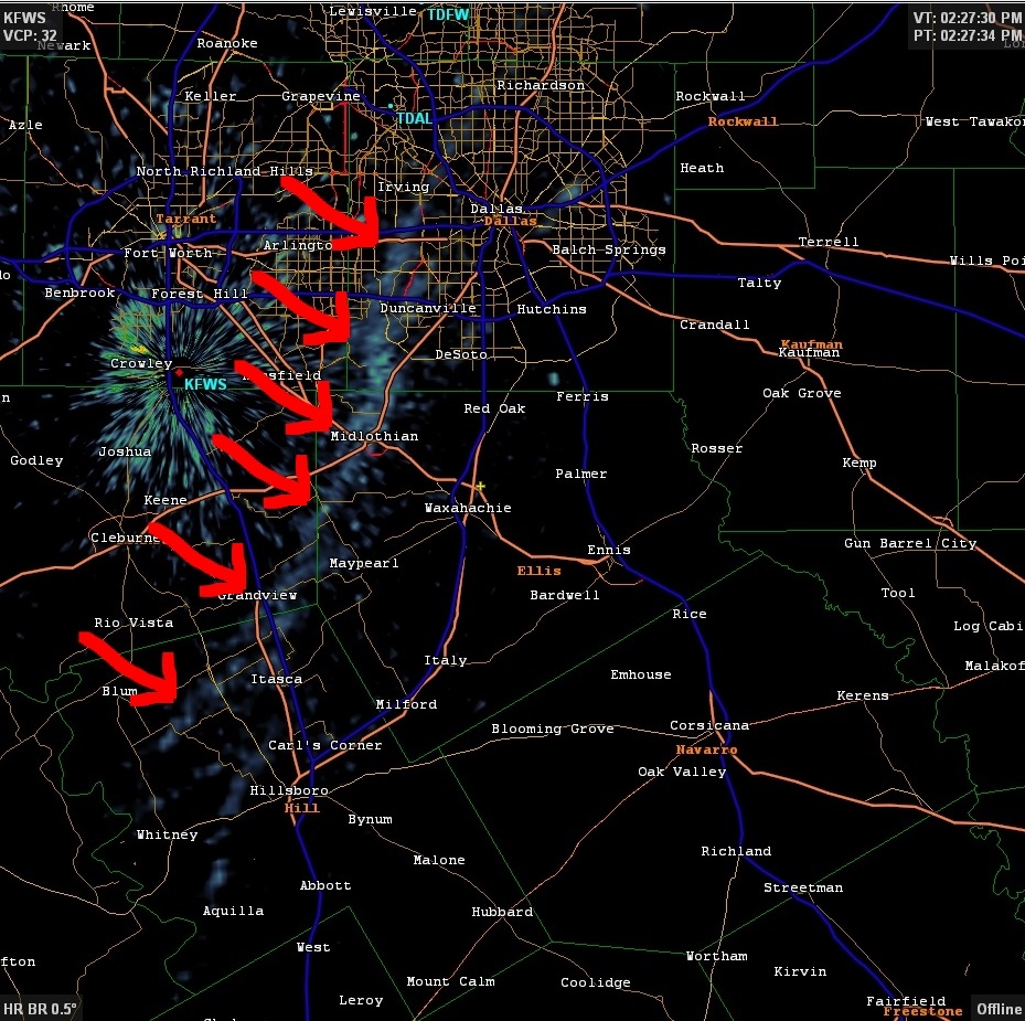
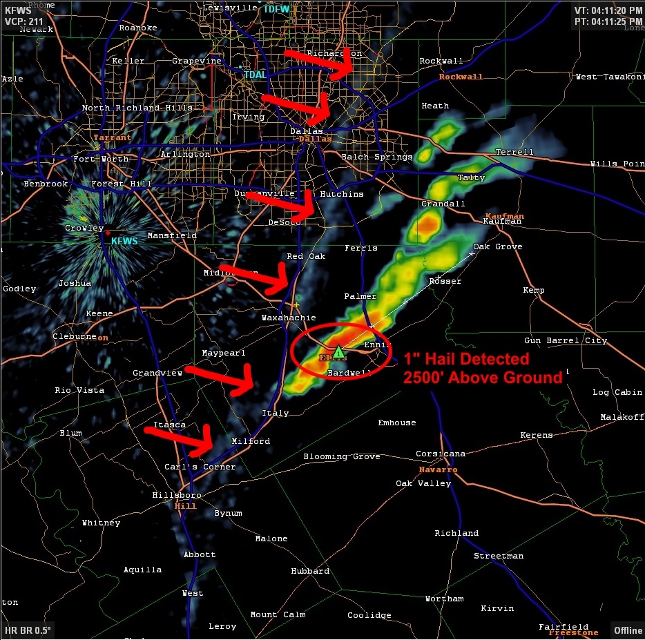
After looking over the radar, I did have some concerns about this storm. For starters, it looked like an HP - or high precipitation - supercell. This type of storm has a tendency to hide its tornadoes in a curtain of rain and makes them extremely dangerous to chase due to the low visibility. To make matters worse, seemingly every storm chaser in the region was converging on this storm. Not wanting to deal with these factors, I began panning around the radar to see what, if anything , we could target. We were still north of Hillsboro, TX when something to our east caught my eye. In the image below, do you see that storm to the west of Corsicana in Navarro County? What about that one? Is it growing/shrinking? Did I see rotation on the radar? All these questions came pouring into my head and I knew that we'd have to make a decision. Was it smart to abandon our initial target and go after a long shot? No pressure whatsoever!!!
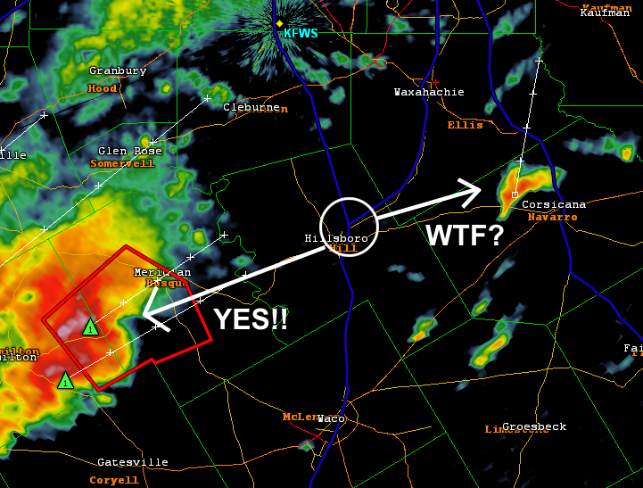
Looking back, I think I made the decision I did out of an abundance of caution. I'm not the most experienced chaser and I did have my wife, father, and kiddos in the car. I really didn't want to approach a rain wrapped tornado and have all things go to hell. Therefore, I made the decision to change the plan mid-way and after arriving in in Hillsboro, we made our way onto TX-22 and blasted east with a new target in mind. All I was thinking was "I hope I made the right choice!!"
What I hadn't taken into consideration that although the new target storm was technically closer, it was also going to be moving away from us - which means that catching up to it was going to take some skill. Any delay we might encounter would just make getting to the storm all the more difficult. As we passed through the small towns along TX-22, the speed limited drastically lowered and I was getting more and more frustrated. As an aside, I always turn out to be the biggest pessimist while chasing. I think that's my way in dealing with a potential bust. In other words, I mentally prepare myself for failing in the event that it happens. What a horrible thing to do! I really need to work on that for next year. :) Ok - lesson learned.
It seemed like an eternity, but we finally made it to Corsicana and, like I eluded to earlier, the storm was much further to our north. We had a lot more catching up to do so we hopped on I-45 northbound. Just north of the town of Rice, TX, we needed to take a more easterly direction to get in a better position so we had to exit the interstate. We opted for FM-1182 which took us to FM-85. We continued on that for a while, then took FM-2613 north. Wait - talk about Déjà Vu! The route we took since exiting the highway matched exactly that of a previous chase from 2014. See that story here! Being familiar with the area and road network boosted my confidence in my ability to catch up with the storm. However, an even bigger confidence boost came from what we saw next.

This may not look like a whole lot, but to a storm chaser, it's validation that you're heading in the right direction. This shot is from northbound on FM-2613 and is looking the storm's backside. The dark area of clouds just beneath the power lines the storm's updraft base. Looking up further is the rest of the updraft core billowing high into the atmosphere.
When you're close enough on a storm for visual contact, it next becomes all about positioning. One technique is to get on the storm's right flank. This is important for a few reasons. First, it allows for the some of the most photogenic views and second, it's one of the safer places to be. Knowing that we were on the storms south side (rear flank), we knew where we had to end up. Upon reaching the town of Kemp, TX, something fantastic happened - the storm became tornado warned! The actual warning was issued at 5:55PM - about 90 minutes after we made the decision to chase down this storm. WHOA! Our luck was suddenly paying off! WOO HOO!
Here's a shot of storm on radar and our position relative to it just after the warning was issued. We seemed to be in a really great position - having placed ourselves east of the storm with a north road option to intercept. Things were now coming together nicely!!

With the chase officially in full force, we drove north on US-175 toward the town of Kaufman, TX keeping eyes on the storm the whole time. 10 minutes later we finally got close enough to see why a warning was issued.
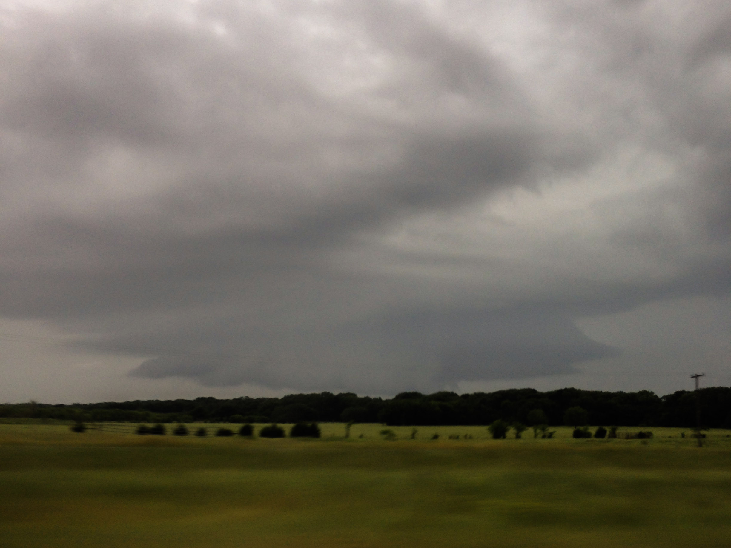
BOOYAH! That my friends is a WALL CLOUD. A wall cloud is the most intense portion of the storm's updraft base and is the area where a tornado will form if conditions are just right.
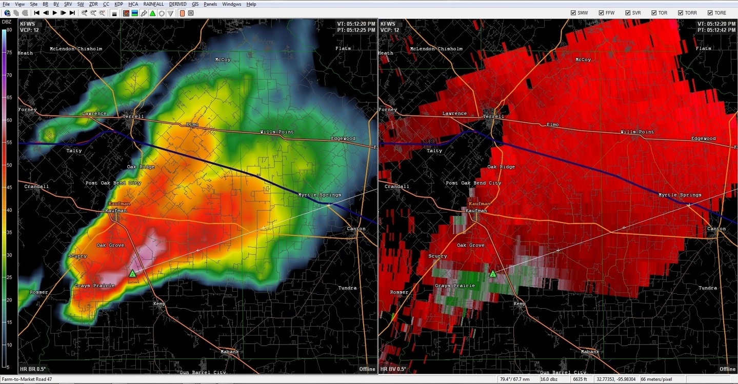
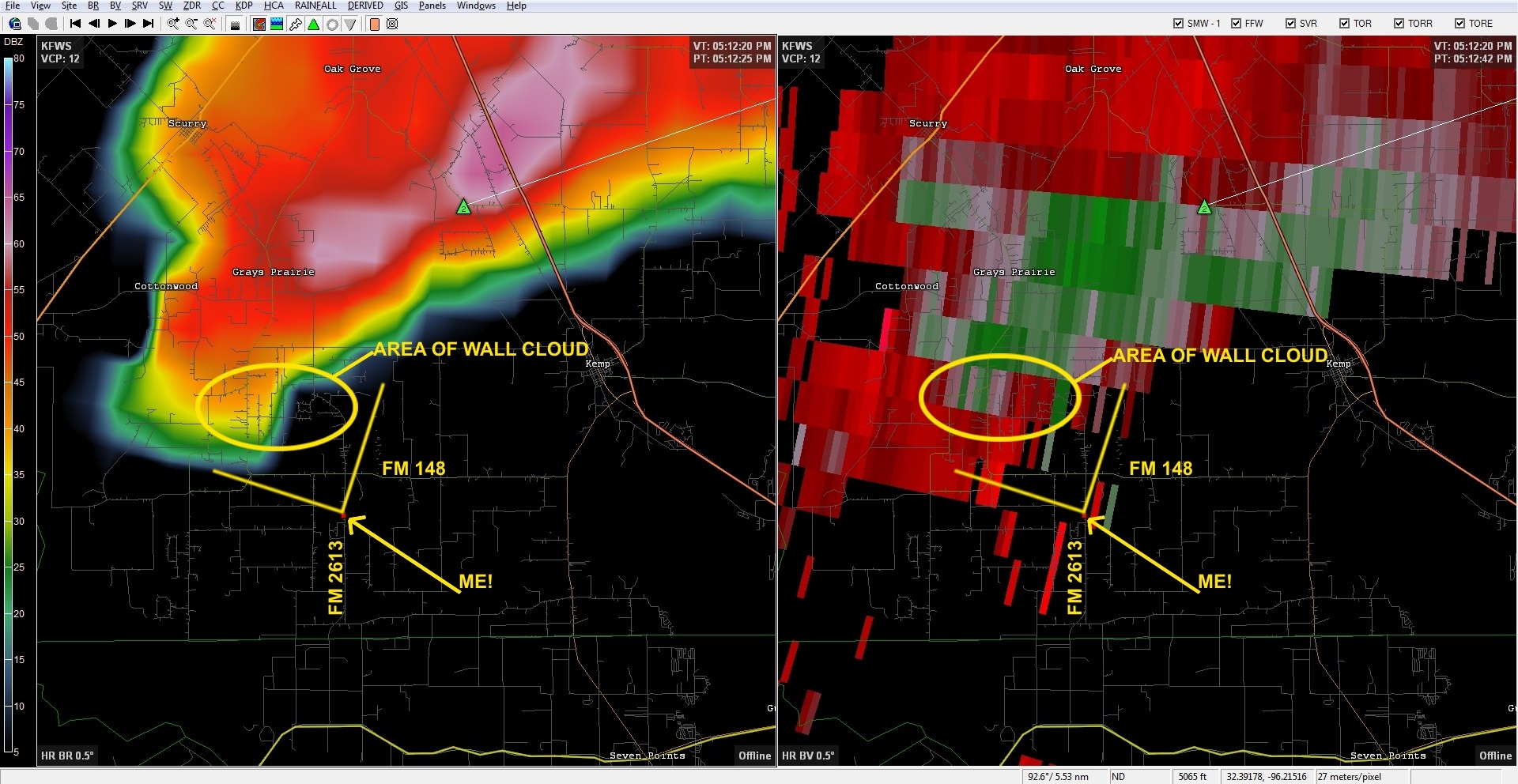
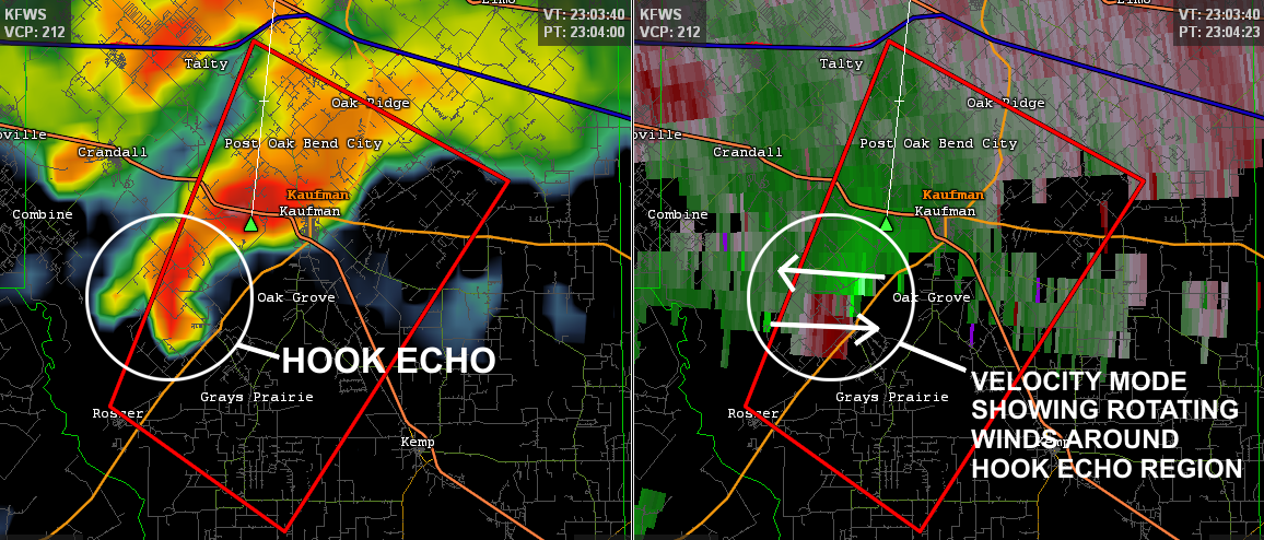
One of the cool things about reconstructing a chase like this is to go back and pour over all the data that you don't have access to in the heat of the moment. I typically only chase with 2 pieces of technology: an iPhone and an iPad. The iPhone is used mainly by me and gives me a quick view of the radar. This helps me know where I am in relationship to the overall storm. I can then relay this to the navigator - usually my dad - who can then tell me what the road options are. The iPad has radar as well, but is used mainly for maps by the navigator. After experimenting with this setup over the course of a few chases, we found that this method works pretty well. Keeping the technology at a minimum, we're not buried in phone and computer screens while on the road and it forces us to actually look at the weather to make sense of it! There are some disadvantages though. The main radar program I use (the one on my notebook) gives a much more detailed view of storms. As an example here is a radar view from the same time frame as the above photo. This is showing the storm's reflectivity data (the amount of precipitation) as well as the velocity data (the wind speed/direction). It clearly shows indicators that would justify the tornado warning being issued - the hook echo and the velocity signatures indicating rotation. While this same data is available via the iPhone/iPad, it's hard to change views on the fly - especially when there is a limited cellular connection.
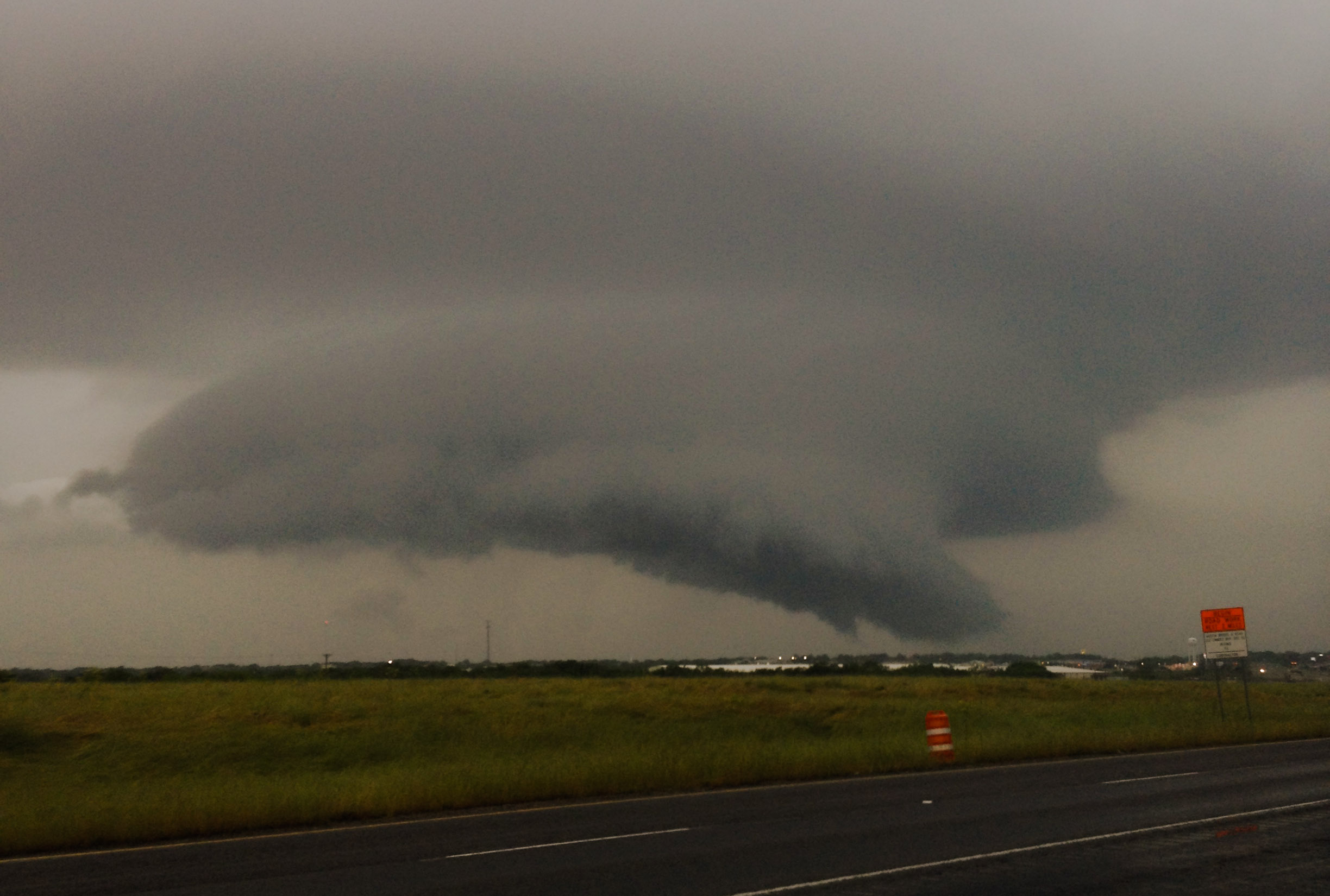
Just LOOK at that beast of a wall cloud. It looked like it was so low, it could almost scrape the ground. Now remember: this is the part of the storm that could produce a tornado at any time. So, while (as least to me) it's the most beautiful, it's also the most dangerous - unless you don't factor in any large hail that could be falling downrange as a result of such a large and powerful updraft. :)
In order to take these pictures we had pulled off the road into a business parking lot. Cars were slowing down along the main highway and we even had people stop to ask what was going on ahead. I was a bit taken back by these questions and wanted to say something snarky, but I quickly relied on my spotter training - which the role is to WARN people - so I let them know that this was a tornado warned storm and to be extremely careful if they were heading up the road.
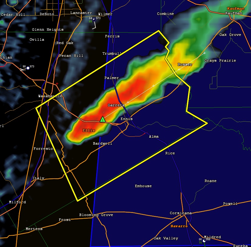
We watched this beast slowly drift northward and when it was clear of US-175, we got back into the car and planned our next move. We decided that following TX-34 out of Kaufman was going to be our best bet. This route was projected to keep us east of the storm all while taking us northward. At 6:30PM a new tornado warning was issued as an extension of the first. The new warned area is shown below.

One of the more important, but difficult aspects to chasing is being able to provide ground truth to the National Weather Service. Ground truth is vital because radar doesn't "see" all the way to the ground. It only sees what's going on higher up above the ground. Furthermore, radar doesn't see clouds. It can only detect precipitation. As a result, meteorologists can infer things are taking place, but confirmation needs to come from people. This is where the role of storm spotters/chasers really comes into play. As an example, take a look at these photos. The first is from about 6:30 PM - the same time the 2nd warning was issued. The second, about 6 minutes later.


What are that white arrows pointing to? Is it a tornado? Is it just another part of the wall cloud? Honestly, the question can't be answered with the information presented. Sure - it may look like a tornado, but here's the textbook definition: a rotating column of air that is extending down from a cloud base AND is in contact with the ground. The problem here is that we can't see the ground and thus can't say for certain what is going on. We can't tell if it's rotating either. This is the real that challenge that storm spotters/chasers face - having to discern what really is from what we think we see. If I had to say, I would classify it as a possible developing funnel cloud.
A few more minutes on the road and we found ourselves at TX-34 and I-20, south of the town of Terrell, TX. We found a place to park and got out to take another shot. The storm was still very much larger than life. By this time a number of vehicles had pulled into the same parking lot to take pictures as well.
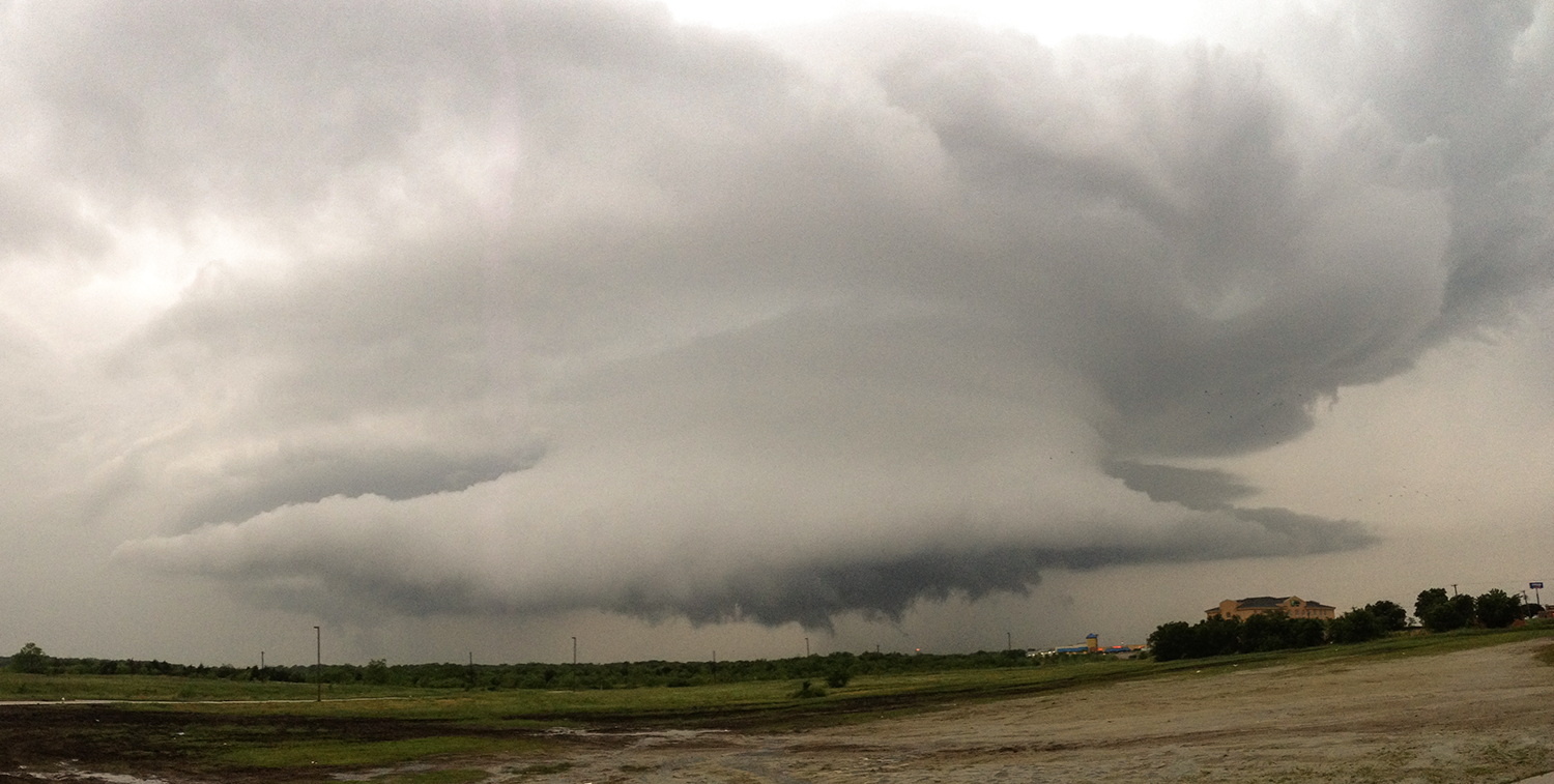
Due to a necessary potty break prompted by the kids, we lost a few minutes on the storm as it passed out of the area. However we were all soon back in the car and on the road. At 6:57 PM, the 3rd tornado warning for this storm was issued.

North of the city of Terrell, TX-34 veers on a more northeast course. This allowed us to stay east of the storm, but the distance between us began to get bigger. We would need to find a different road option soon or we may would have to break off the chase. We still had some daylight left, but I knew it was possible that as the sun was continuing to go down, the lack of heating could be enough to begin weakening the storm. I couldn't pinpoint the cause - but the entire structure of the storm was changing. It could have been our increasing distance, but it also could have been because the storm was in the process of dying out. With that said, around 7:04 PM we saw was appeared to be another funnel cloud develop.

We kept a very close eye on this, but over the course of the next few minutes, the funnel dissipated. From this point on the storm was definitely in the process of dying. The structure began to decay and lose its distinctive shape. By the time we got to Quinlan, TX, we officially called off the chase. At 7:30 PM the 3rd and final tornado warning associated with this storm was left to expire on its own. We jumped onto I-30 for the long drive home. I really would have liked to see a tornado that day, but looking at how many residential areas this storm passed over, I'm relieved that we didn't. While some chasers may have called this a bad day, there were many things I considered to be wins. Every chase is an opportunity for me to hone my skills. Ditching a larger storm for something smaller one may have been a long shot, but it definitely paid off this time.
-Andrew